The Micoque loop: Hiking in Les Eyzies

Les Eyzies de Tayac
The Micoque loop: Hik ...

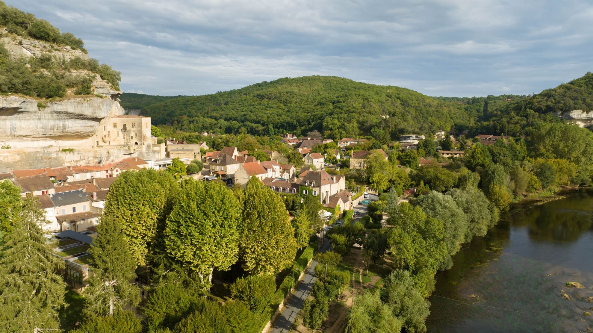
The Boucle de la Micoque is a hike that starts in Les Eyzies, the capital of prehistory in Périgord Noir and which travels for 15 to 20 km in the village then on the wooded heights, passing near several deposits and notorious sites of discoveries on the History of Humanity, in the region. The highlight is, as its name suggests, the Micoque site, which is the oldest excavation site in the Vézère Valley. A nice walk, to be done partly as a family, in its entirety with good shoes and water. We'll take you there by bike, but may the amateur sportsmen be ready to push their mounts for the most demanding kilometer!


Photos: © Guide du Périgord


Before leaving, take the time to read the following document (click) (fr), published by the International Pole of Prehistory, to understand what you will discover during the hike and locate the route.

Les Eyzies - The Micoque loop
Les Eyzies, the National Museum of Prehistory and its semi-troglodyte dwellings

sponsored content

One of the most interesting hikes in the region

The Boucle de la Micoque appeals to holidaymakers, and with good reason, because it is a very interesting walk. Between the educational circuit and the sporting stroll, you spend an instructive moment discovering the pretty center of the village of Les Eyzies, then you move away to appreciate beautiful perspectives, along the Vézère river and then on the heights, with beautiful panoramas.

In winter, it is a pleasant hike because it is very bright and sunny. Apart from a passage in the shade of the limestone cliff along the departmental road, you move in the sun. The forest is populated with deciduous tree species, which let in the winter sun, on a soft carpet of chestnut leaves, hazelnuts and oaks.

In the summer, take a cap or hat to cross town and pass along the river, which can be in the sun depending on the time of day. You have water points to refresh yourself (but not to fill the gourd), as in the car park in front of the Grotte du Grand Roc, or not far from the bridge. In the forest, the density of the trees and their green foliage will protect you from the sun, it will be very pleasant to walk, throughout the climb, but also the descent which offers beautiful views.

The Micoque Loop is between 15 to 20km. 15 km if you follow the signs and 20 km if you make a detour to the canoe bases, on the other side of the village to enjoy a beautiful point of view on the troglodyte cliffs of the Museum of Prehistory.


Panoramas of Les Eyzies
Winter panorama of Les Eyzies from the bridge
Les Eyzies - The Micoque loop  Les Eyzies - The Micoque loop
A stroll on foot or by bike, between the city and the forest

sponsored content

The Micoque loop, prepare your hike

Click to see the circuit and export the GPS data, from the site of our partner CIRKWI (fr)

I recommend that you park in the parking lot of the PIP (the International Pole of Prehistory) or in the parking lot at the edge of the Vézère at the end of the village on the left. The complete hike and on foot will take around 5 hours, depending on your pace. If you do the circuit by bike (like us), you will have about 2 hours, taking your time. Please note, this is a hike that is primarily intended for pedestrians. Also, bikes must respect hikers, get off 2 wheels where necessary. You also need good physical condition to climb the part in the forest, from km N°4 to km N°8, it is a loop with a positive elevation of 440m. On foot, no worries, by bike… For my part, I had to go down and push, but only for 800m.


Prehistory Museum
Start in front of the museum, browse in the adjacent pedestrian lane, very nice!
Ruelle les Eyzies, clumsy shelters  Shelter Pataud
Abri Pataud, with its explanatory panels
The Cro-Magnon shelter, near the bridge over the Vézère, designed for pedestrians

From the PIP, go to the National Museum of Prehistory. Take the opportunity to stroll through this charming and pedestrianized little street. Take a very small alley, which runs along the cliff in the direction of Abri Pataud. You then come out on the road, go in the direction of the Cro-Magnon shelter, then turn left. You will join the Vézère, spanned by a bridge that leads you along the limestone cliff. Walk admiring this magnificent witness to the past, admire the natural cavities and the notches in the rock, made by man to support frames, install cupboards, take possession of the mineral to make it a habitat, from the most rudimentary to the most developed for 400,000 years!

On your left, the Fort du Roc de Tayac, a little further on, the Grotte du Grand Roc and Laugerie Basse, but also semi-troglodyte houses which take advantage of the rock that they marry, a modern reproduction of the mud walls from medieval times. Just before the small bridge where it is difficult to get around, turn right into the field, towards the large bridge with several pink arches. You thus cut the dangerous part of the D47 road. Arrived in a quiet area with a few houses (follow the signs carefully, stay on the path to respect the properties), you turn left to go towards the Micoque deposit. It is indicated on your right, make a small detour to discover the place where the excavations revealed very old vestiges of human presence in the stratigraphic sections (kinds of earth cores, studied in layers to date the fossils and artefacts discovered).


Les Eyzies - The Micoque loop
The Vézère
Les Eyzies - The Micoque loop
Just opposite, the cliffs and the Grotte du Grand Roc site
The POnt of the BOucle de la Micoque  Les Eyzies - The Micoque loop
Take in the field, to pass under this bridge and avoid the departmental road on a dangerous section


You then climb in a very pretty part of the forest, with some descriptive panels of the flora and the landscapes. At the top, turn right (everything is indicated) you are on a plateau with beautiful views over the valley. Before going down frankly, there is a viewpoint on the cliffs and you can see as far as the Madeleine site, in Tursac (depending on the pruning...).

Go back down to turn back towards Les Eyzies, passing why not under the bridge before the village and then continuing along the Vézère. At the end of the limestone path, where canoe bases are installed, you have a very nice view of the village and the cliffs of the Museum of Prehistory. Then go back to the village, it's the end of the hike!


Les Eyzies - The Micoque loop
We attack the section that climbs in the forest
Les Eyzies - The Micoque loop  Les Eyzies - The Micoque loop
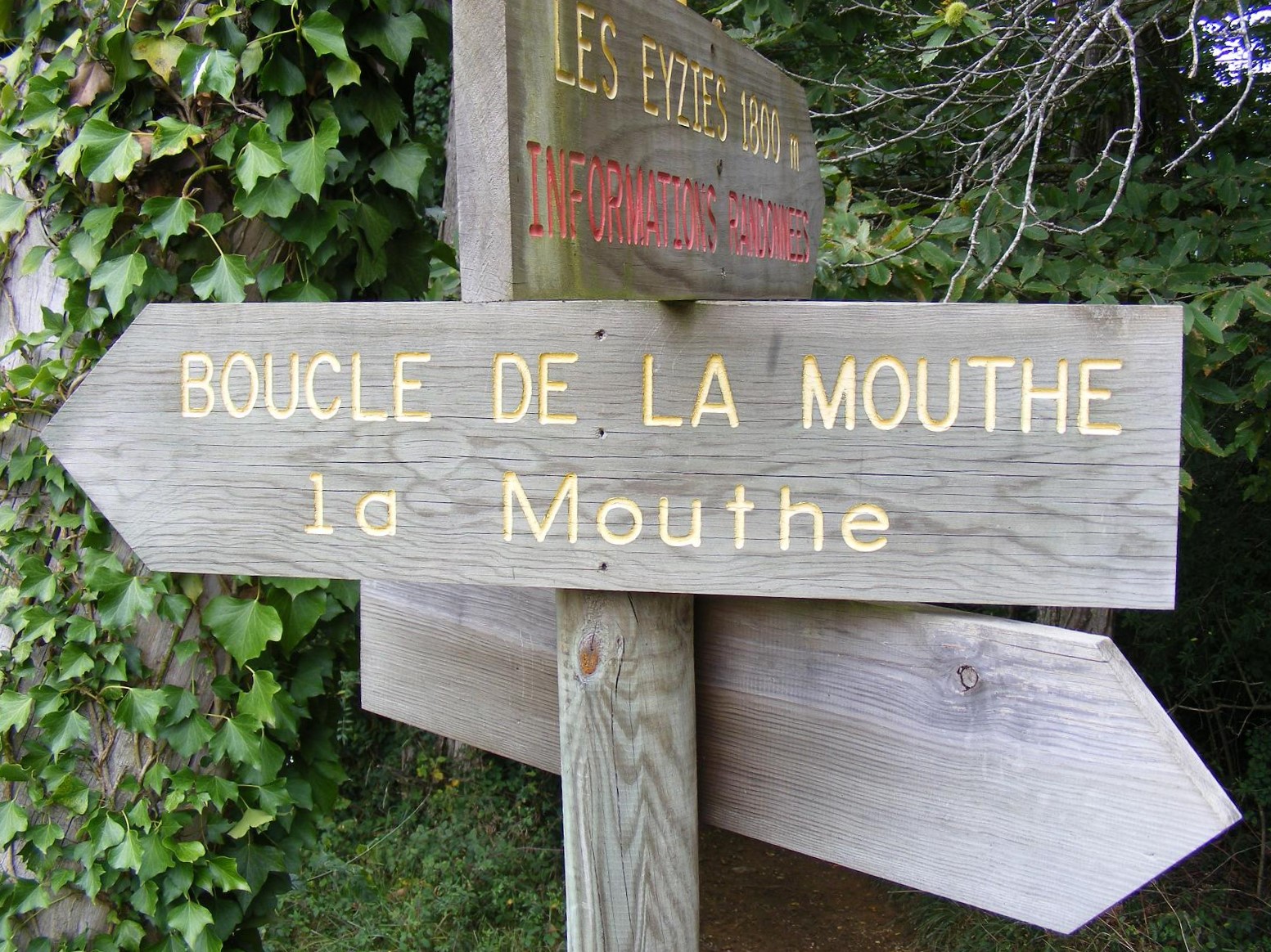
You are tired? Rest while reading the signs
Les Eyzies - The Micoque loop  Les Eyzies - The Micoque loop
The forest path returns to a plateau, before descending, towards an orientation table and a landscape diagram. But during my visit, there was no "point" of view, because of the trees being pruned... You will have the chance to see the Madeleine next time!

sponsored content

You now know more about the major excavation sites in the region, thanks to the explanatory panels during the hike. You can contact the Lascaux Dordogne Vallée Vézère Tourist Office to find out more about the visits. For other hikes, look at the bottom of this page, with our partner CIRKWI who offers nearby routes!


Did you like our article? Find others on the Guide du Périgord blog. Find us on the Facebook page of the Guide du Périgord, as well as on our Instagram account @Guideduperigord


VIEW of Eyzies


Back to "Sport"

You will also like

100 years of the Grotte du Grand Roc

100 years of the Grotte du Grand Roc

Les Eyzies de Tayac

The Font de Gaume cave

The Font de Gaume cave

Les Eyzies de Tayac

The Château de Commarque: surprising stone fortress

The Château de Commarque: surprising stone fortress
The Château de Commarque: surprising stone for ...

Les Eyzies de Tayac

The Fort du Roc de Tayac in Les Eyzies: "rebirth" visit of a site that is awakening

The Fort du Roc de Tayac in Les Eyzies: "rebirth" visit of a site that is awakening
The Fort du Roc de Tayac in Les Eyzies: "rebir ...

Les Eyzies de Tayac

The Abri Cro-Magnon

The Abri Cro-Magnon
The Abri Cro-Magnon

Les Eyzies de Tayac

You will like also

Fort du Roc de Tayac

Fort du Roc de Tayac

Perched 50m above the Vézère, Grand Site de France, follow Marie's twirling visits to the heart of the most ...

457 m - Les Eyzies de Tayac

Cro-Magnon shelter

Cro-Magnon shelter
Cro-Magnon shelter

Visit the site of the discovery of the world's most famous prehistoric man, Cro-Magnon. On the authentic place where ...

467 m - Les Eyzies de Tayac

Prehistoric Shelters of Laugerie Basse

Prehistoric Shelters of Laugerie Basse

LAUGERIE-BASSE: EXPERIENCE THE HISTORY OF MEN Listed as a UNESCO World Heritage Site, the Laugerie-Basse Prehistoric ...

870 m - Les Eyzies de Tayac

Grand Roc Cave

Grand Roc Cave
Grand Roc Cave

Grotte du grand roc: THE SECRETS OF THE UNDERGROUND WORLD Nestled in the cliffs of the Vézère Valley, the Grotte ...

871 m - Les Eyzies de Tayac

Musée National de Préhistoire

Musée National de Préhistoire

The National Museum of Prehistory is located at the heart of a group of prehistoric sites, in the town of ...

991 m - Les Eyzies de Tayac

Ride around

Boucle de Gorge d'Enfer n°12 / Les Eyzies

Boucle de Gorge d'Enfer n°12 / Les Eyzies

683 m - Les Eyzies de Tayac

Walking

Boucle de la Mouthe n°13 / Les Eyzies

Boucle de la Mouthe n°13 / Les Eyzies

683 m - Les Eyzies de Tayac

Walking

Boucle de Gorge d'Enfer n°12 / Les Eyzies

Boucle de Gorge d'Enfer n°12 / Les Eyzies

683 m - Les Eyzies de Tayac

Walking

Boucle de la Mouthe n°13 / Les Eyzies

Boucle de la Mouthe n°13 / Les Eyzies

683 m - Les Eyzies de Tayac

Walking

Boucle de la Micoque n°15 /Les Eyzies

Boucle de la Micoque n°15 /Les Eyzies

735 m - Les Eyzies de Tayac

Walking